Land to the North of Spring Hill Today
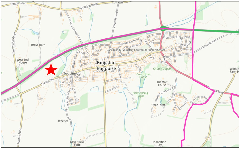
Land to the North of Spring Hill currently comprises two fields, covering approximately 11.4 hectares. It is bound by the A420 to the north and Spring Hill to the south, Charney Road to the west and the edge of the Kingston Bagpuize with Southmoor to the east.
Hedging and tree cover is significant along the boundary with the A420, providing a natural visual and sound barrier.
The site has strong defensible boundaries on all sides with tree belts and hedgerows situated along the perimeter. The site abuts the western edge of Southmoor and is also surrounding by residential dwellings on the southern side of Spring Hill. The site wraps around a further residential dwelling, ‘The Lodge’, located on the northern side of Spring Hill.

The red star on the above map shows the proximity of the new homes to the centre of the village
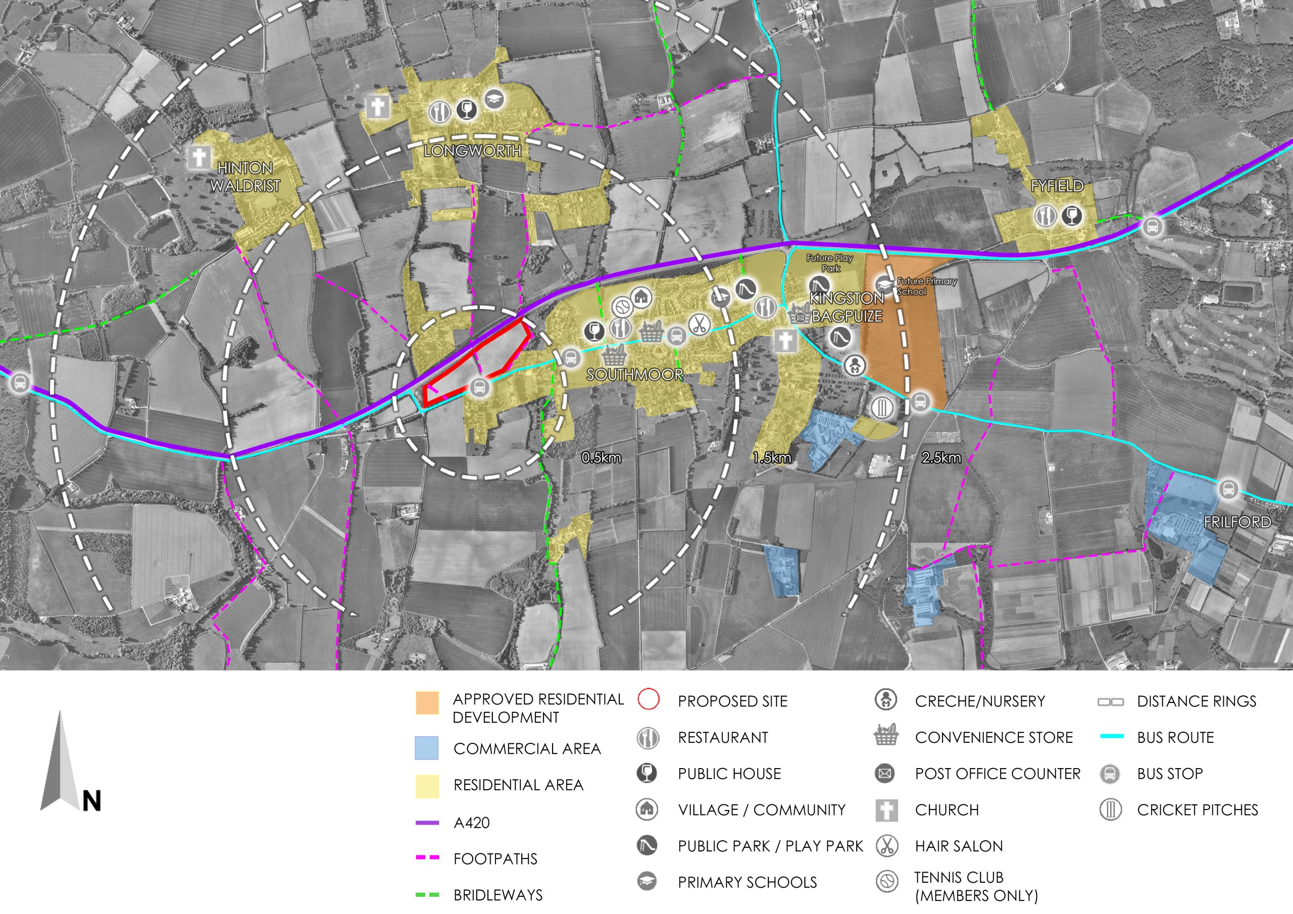
The site represents a logical extension to the village and provides good access to existing amenities. Kingston Bagpuize with Southmoor is largely residential with a number of facilities dispersed throughout. Further development will help support these facilities as well as providing additional facilities to be utilised by new and existing residents.

The above map indicates the proximity of the site in relation to local facilities
Key services and facilities include/or will include:
- John Blandy Primary School
- A number of food retail convenience stores
- A Post Office counter in the local food retail convenience store
- A public house
- A village hall
- A scout hut
- A hair salon
- Cricket & sports facilities and new sports pavilion
- A new local centre as part of the approved development to the east of the village
- A new primary school as part of approved development to the east of the village
Contact Us
If you have any queries, please contact Melisa Geshteja of SP Broadway via melisa@spbroadway.com

